New mapping techniques pave the way for better understanding of soil informing sustainable development of agriculture
Researchers from Aarhus University have studied the development of mapping initiatives, soil surveys and soil monitoring programmes in Denmark. The researchers aim to use this knowledge to improve soil understanding by using advanced mapping techniques such as remote sensing, geospatial modelling and machine learning.

Soil monitoring is essential to understand the status of soil functions (soil health) and support sustainable development of agricultural systems. Recently, the European Commission proposed the Soil Monitoring Law to monitor the soil health status across Europe, and Danish soil survey programs show how soil information can be important to support sustainable development.
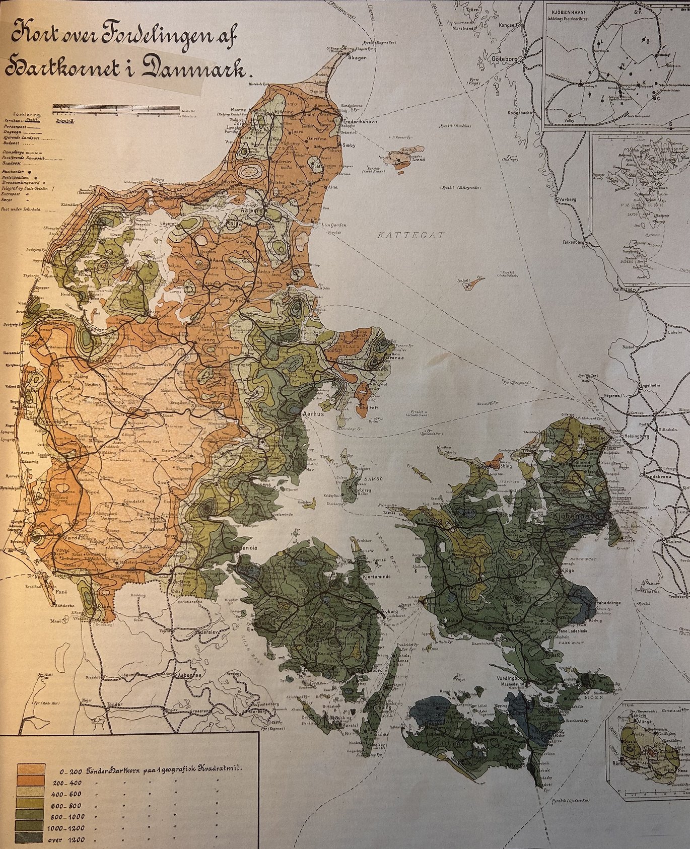
Soil mapping in Denmark is nothing new, but researchers have now looked back at the historical development to examine the impact of mapping on various initiatives, soil inventories and environmental monitoring.
The study focuses on the development of soil and environmental inventories and the evolution of mapping from hand-drawn maps to digital maps. The researchers have also investigated how mapping techniques have contributed to a better understanding of soil functions such as carbon sequestration, water transport, agricultural production and pollution risks, thus shaping the initiatives taken by decision-makers and policy makers.
"The purpose of our study is to set a direction for improving mapping. The more we know about the soil, the better we can implement initiatives to combat climate change and ensure sustainable food production. The knowledge generated by mapping is useful for decision-makers and farmers. And the more detailed the mapping is, the more knowledge we gain, making it easier to decide which initiatives are needed to keep the soil healthy and achieve the services we want from the soil,” says postdoc Lucas de Carvalho Gomes from the Department of Agroecology at Aarhus University.
A historical overview helps define future actions
Denmark has a tradition of performing soil surveys, initially to determine tax revenues and later to help politicians and farmers make the best decisions to protect the environment and maintain a healthy and productive soil. This knowledge has supported the development of intensive farming systems and sustained ecosystem services, such as ensuring clean drinking water.
According to the researchers, a historical overview of soil investigation and mapping methods will make it easier to identify a direction for future research and mapping of the soil in Denmark to best safeguard the soil and ecosystems in the future in terms of climate, environment and sustainability.
"We have examined the development of soil and environmental inventories, the historical development of soil mapping methods and how these factors have contributed to a better understanding of soil functions. Specifically, we discuss soil functions related to water regulation (e.g., groundwater and surface water protection), water filtration (e.g. nitrate leaching), carbon sequestration (e.g. peatlands), agricultural production (e.g. soil suitability, wheat yield) and threats related to soil degradation (e.g. soil erosion)," says Lucas Carvalho Gomes.
People very often argue that soil surveys are too expensive, but this study shows that for example soil observations made in the 70s are still valuable for better understanding the development of soil properties and the soil variability in Denmark. Soil surveys are long term investments and can support future generations to sustainably manage the soil resources.
Innovative approaches to mapping
Conventional methods such as chemical analysis and physical measurements provide valuable data but are not always sufficient to provide the full picture of soil health and functionality. Therefore, researchers have integrated new technologies such as remote sensing, geospatial modelling and machine learning to develop a more comprehensive and detailed approach to soil mapping in Denmark.
“We have focused on different areas in Denmark where different soil types and uses have been investigated. In other words, we have collected extensive soil samples and conducted field studies to validate different mapping models,” explains Professor Mogens H. Greve from the Department of Agroecology at Aarhus University, and continues:
“The result of the more detailed and innovative mapping is a valuable insight into variations in soil health across regions. It can ultimately help policymakers, farmers and land managers to make informed decisions about land use planning, crop selection and soil protection.”
The study also has the potential to be used outside of Denmark. According to the researchers, functional soil mapping can be applied globally to help improve soil management and achieve sustainable development goals. It offers a cost-effective method to assess and monitor soil health, which is essential to combat climate change, protect biodiversity and ensure food security.
“By applying innovative approaches such as machine learning, satellite imagery, remote sensing and so on, we can open up new opportunities for implementing sustainable agriculture and conservation worldwide," says Lucas de Carvalho Gomes.
| ITEM | CONTENT AND PURPOSE |
|---|---|
| External collaborators | Department of Agroecology at Aarhus University, Geological Survey of Denmark and Greenland, USDA - Agricultural Research Service, Roskilde University, University of Copenhagen and Colorado School of Public Health. |
| External funding | The study was supported by the SustainScapes project - Centre for Sustainable Landscapes under Global Change (grant number: NNF20OC0059595), and the ReDoCO2 project with funding from Innovation Fund Denmark (grant number: 0177-00086A). |
| Conflict of interest | None |
| Link to the scientific article | The publication "Soil assessment in Denmark: Towards soil functional mapping and beyond" has been published in the journal "Frontiers in Soil Science". It is written by Lucas Carvalho Gomes, Amélie Marie Beucher, Anders Bjørn Møller, Bi V. Iversen, Christen Duus Børgesen, Diana Vigah Adetsu, Gasper Laurent Sechu, Goswin Johann Heckrath, Juilan Koch, Kabindra Adhikari, Maria Knadel, Mathieu Lamandé, Mette Balslev Greve, Niels H. Jensen, Sebastian Gutierrez, Thomas Balstrøm, Triven Koganti, Yannik Roell, Yi Peng and Mogens H. Greve. |
| Contact information | Postdoc Lucas de Carvalho Gomes, Department of Agroecology, Aarhus University. Email: lucas.gomes@agro.au.dk Professor Mogens H. Greve, Department of Agroecology, Aarhus University. Tel: 20726734 or email: greve@agro.au.dk |
